Mapping the National Parks
Nature Valley | Trail View | Online
Project Highlight:
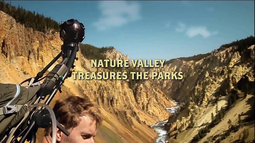
We figured out how to hack the Google Street View Camera (Dodeca 2360), the first camera capable of capturing nearly spherical 360 video, and put it on a backpack to hike the three parks and over 300 miles.
Challenge:
Most of the National Parks in the US are either never experienced at all or through a car windshield. How do we bring the parks to the larger public?
Design Approach:
The Trail View project was born out of Nature Valley’s commitment to nature and their mission to preserve it.
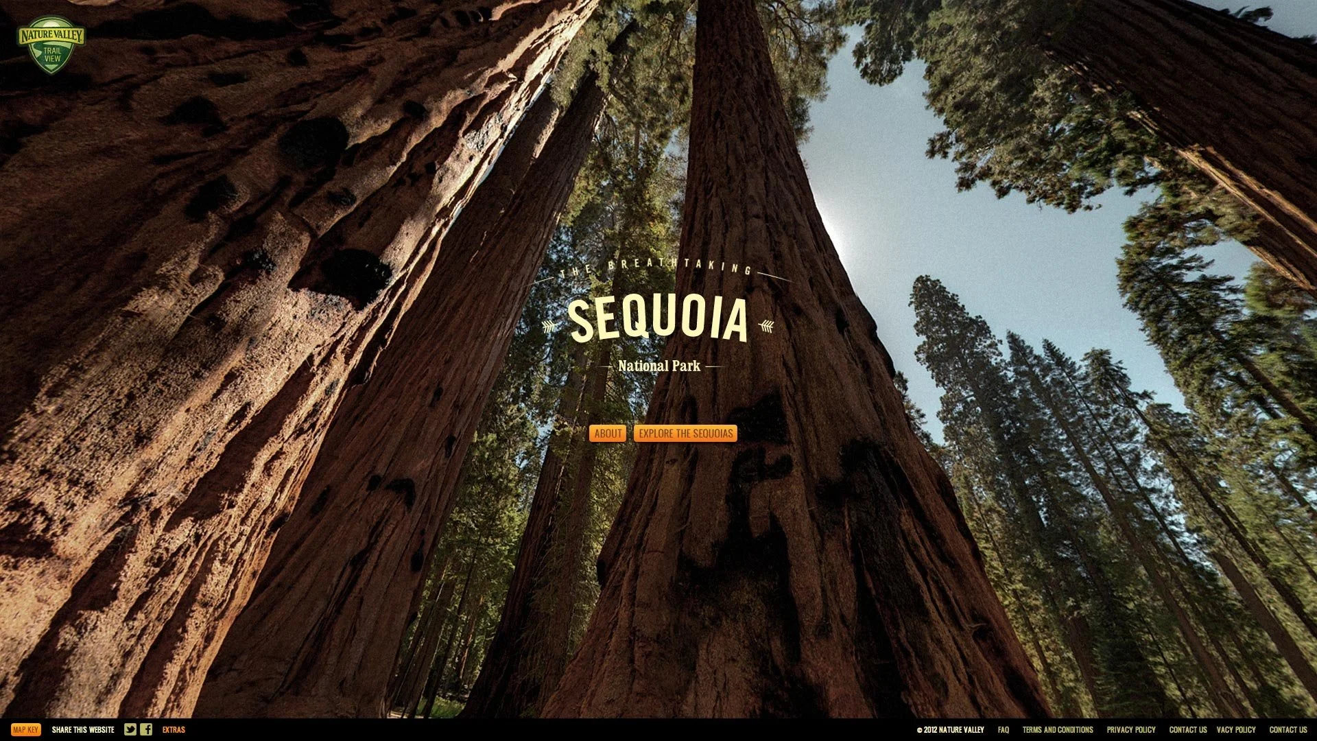
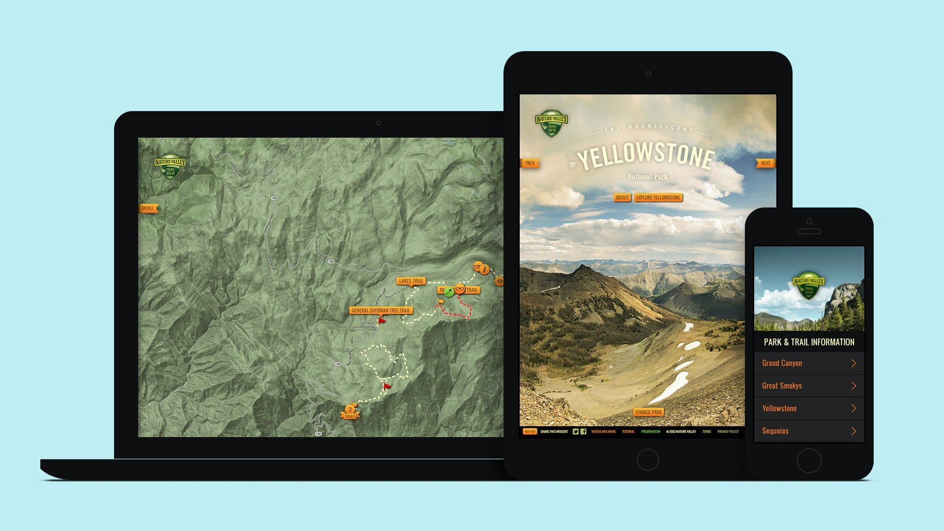
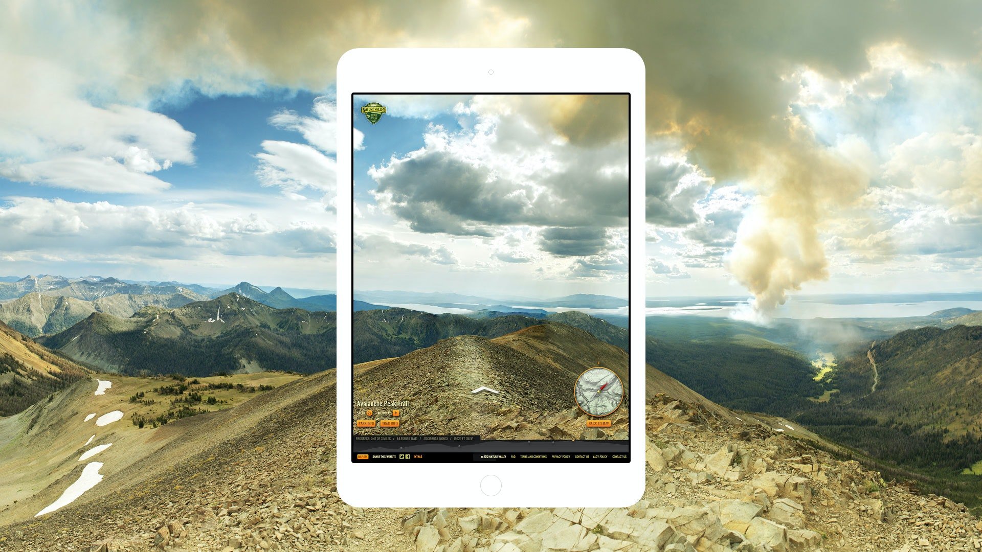
Called Nature Valley Trail View, the first-of-its-kind platform brings together 300-plus miles of immersive national parks content through panoramic views and interactive guides to three of our most iconic parks – Grand Canyon, Great Smoky Mountains and Yellowstone.
Choosing from Grand Canyon, Yellowstone, Great Smoky Mountains and Sequoia, hikers can pick one of the parks and explore its trails in depth via a topographic map. Trail View 2.0 also highlights Nature Valley’s preservation efforts, flora and fauna and mobile-optimized experience.


Praise
34 awards including 2x Cannes Cyber Lions, 2x Clios, and 2x Webby wins